A World Geopark is a significant geological relic landscape with unique geoscientific, natural, and ornamental value.
These parks are recognized and approved by UNESCO after expert visits and evaluations. Currently, 147 members of the UNESCO World Geopark Network are located in 41 countries and regions worldwide.
The World Geopark has three primary functions. Firstly, it serves as a vital resource utilization tool in protecting geological relics and ecological environmental preservation. Secondly, it plays a significant role in scientific research and knowledge dissemination, international exchange, and improving the scientific literacy of people worldwide.
Thirdly, becoming a World Geopark has a positive effect on upgrading the original scenic spots and infrastructure, promoting and developing local tourism, and fostering local economic development.
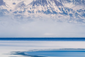
The Alashan Desert World Geopark is located in the Alashan League, which is the westernmost part of the Inner Mongolia Autonomous Region. It is the only desert geopark worldwide, with the natural landscape geopark mainly consisting of the Badangilin Desert, Tengger Desert, Ejinnar Poplar Forest, and Orenblaag Canyon.
Due to its unique geographical location, geological structure, ecological environment, and climatic conditions, the park boasts a geological landscape primarily of desert and Gobi, which comprehensively reflects typical geological relics formed by wind geology in the northwest region.
It is the only world geopark that systematically and completely shows the process of wind geology and primarily desert geological relics.
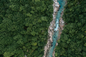
The China Yuntai Mountain World Geopark is located at the southern foot of the Taihang Mountains, covering a total area of about 556 square kilometers. It is a comprehensive geopark with scientific and aesthetic values, focusing on rift valley tectonics, hydrodynamics, and geological landscapes, supplemented by natural ecology and humanistic landscapes.
The park comprises a series of geological relics with unique scientific significance and aesthetic value that represent the geological history and geological action of the region. The "Yuntai landform" formed in the context of rifting is a typical remnant of the neotectonic movement.
On the ancient core of North China, which has been in a tectonically stable state for an extended period, a set of relatively complete and representative platform-type sediments has been developed, and the sedimentary remains of the marine environment, especially the land surface marine environment, of the Middle Age and Paleozoic have been entirely preserved.
The unique geotectonic position has created exceptional hydrodynamic conditions and shaped the park's distinct geomorphological features.
To ensure the sustainable development of these World Geoparks, it is essential to establish a special tourism and service system and produce and sell local special products and souvenirs actively.
This will help to expand commercial activities, improve the employment and economic development of residents, and create an environmentally friendly and circular economy while also promoting industrial renewal.
In conclusion, World Geoparks play a significant role in the protection and preservation of geological relics, scientific research and knowledge dissemination, and local economic development through tourism. The Alashan Desert World Geopark and China Yuntai Mountain World Geopark are two examples that showcase unique geological landscapes with unparalleled scientific significance and aesthetic value.
These parks serve as excellent models for sustainable development, promoting tourism and economic growth while preserving the environment for future generations.